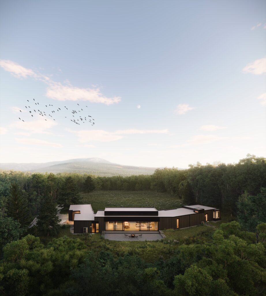
3D aerial rendering is a powerful tool in architectural visualization that allows architects, developers and real estate professionals to showcase their projects from a bird’s-eye view. By presenting designs from a top-down perspective, 3D aerial renderings offer an immersive and comprehensive look at the entire site or development, highlighting the relationship between buildings, landscaping and surrounding environments. Whether for urban planning, large-scale developments or real estate marketing, aerial renderings provide an elevated perspective that enhances the overall visual impact of a project.
Large-Scale developments.
One of the most significant advantages of 3D aerial rendering is its ability to capture large-scale developments. When dealing with extensive residential complexes, commercial developments or mixed-use properties, an aerial view allows for a clear presentation of how the entire site fits together. Aerial renderings can help potential buyers, investors and city planners better understand the overall layout, scale and design of the development. By visualizing the project from above, stakeholders can see how the buildings relate to each other, the flow of traffic, surrounding streets, parks, and other amenities, offering a holistic view of the entire project.
Aerial renderings are an invaluable tool for site planning and urban design projects. They allow architects and urban planners to visualize how new buildings will integrate into existing communities and how they will affect the surrounding environment.
With an aerial rendering, planners can assess aspects like access roads, green spaces and pedestrian pathways, ensuring that the design is both functional and aesthetically pleasing. Aerial views also help in demonstrating how the development will impact neighboring properties, such as the distance between buildings, views and sunlight exposure.
For real estate marketing, 3D aerial renderings are a powerful tool that helps promote properties, especially large residential or commercial developments. Potential buyers and investors can gain a clear understanding of the entire property and its surrounding area, including the proximity to key landmarks, transportation routes, and amenities. Aerial renderings can be used in promotional materials such as brochures, websites and advertising campaigns to show the property in a stunning, high-quality visual format. By presenting the site from above, it helps potential buyers get a feel for the location, layout, and environment before making any decisions.
When working with natural landscapes or projects that are being developed in sensitive environments, 3D aerial renderings can highlight how the design integrates with its surroundings.
Projects near bodies of water, forests or mountain ranges, aerial renderings can show how the buildings and infrastructure are aligned with the natural elements. These renderings can emphasize the environmental impact of the development, showing how it complements or enhances the existing landscape rather than disrupting it. This is particularly valuable for green-building projects or sustainable designs where ecological sensitivity is a priority.
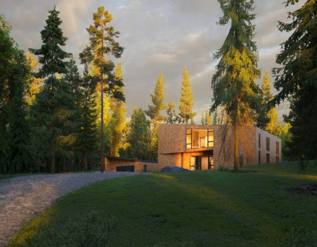
An aerial rendering provides an opportunity to show potential views from above, giving clients an understanding of how the future development will look once completed. This includes showcasing the relationship between the building, the surrounding streets, public spaces, and even distant landmarks.
For real estate developers, aerial renderings can show potential buyers how they will experience the property from different vantage points. For example, the view of a residential complex from above might show proximity to scenic vistas, nearby parks or urban landmarks, which can be a significant selling point.
When seeking planning permission or working with local authorities, aerial renderings can be a useful tool to present a clear and comprehensive view of the project. They help communicate the scale, scope and impact of a proposed development to stakeholders such as city officials, zoning boards, or neighborhood associations. By offering a visual overview from a bird’s-eye view, stakeholders can better understand the potential benefits and challenges of the project. This is especially useful in urban developments or large-scale projects where visualizing the entire site can be crucial for decision-making.
Creating stunning visual impact for presentations
Aerial renderings create a striking visual impression, especially when incorporated into presentations for clients, investors or stakeholders.
These renderings help grab attention and showcase the project in a way that floor plans or 2D drawings cannot. By offering an aerial 3D renders, high-quality view from above, you provide an immersive and compelling way to present your project. Whether as part of a pitch to investors or a marketing campaign for potential buyers, aerial renderings help communicate your vision in a way that engages and excites your audience.
With aerial 3D animation, you can virtually “fly” through the space, experiencing the development from multiple perspectives. This dynamic approach allows users to see the project evolve, zooming in on specific areas or zooming out to capture the larger context. These interactive features help provide a deeper understanding of the space, making it easier to visualize how you will experience the finished development.
3D aerial rendering is an essential tool in architectural and real estate marketing, offering a comprehensive, high-quality perspective of a site or project. Whether used for site planning, urban design, real estate promotion or development approval, aerial renderings provide a clear, immersive and visually striking view of a project’s potential.
By presenting designs from above, aerial renderings offer an effective way to communicate a project’s scale, integration, and impact, making them an indispensable tool for architects, developers and marketers alike.